


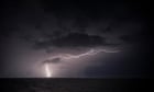
A tropical low known as 18U will bring strong winds, heavy rain and storm surges to the north of the country
The Bureau of Meteorology has issued a tropical cyclone alert for the north coast of Western Australia. This alert concerns a tropical low known as 18U, which has been spotted near the coast of Kimberley, situated in the north-west of the state. Strong winds, heavy rain and storm surges will affect northern Australia starting on Sunday night, with a flood warning also being issued. Under current forecasts, 18U will continue to push south-westwards along the warm water off Western Australia into the new week and is expected to strengthen to a tropical cyclone, which will be named Zelia. By the end of the week, the cyclone is expected to make landfall around the Pilbara region, bringing about 150mm-250mm (5.9in-9.8in) of rain locally, alongside wind gusts of about 100mph.
Meanwhile, Canada has once again been experiencing a severe cold spell after polar air moved in from the north, allowing temperatures to fall 5C-10C (41C-50F) below the seasonal average. Western Canada is particularly badly affected, with the cities of Calgary, Edmonton and Saskatoon potentially experiencing maximum daytime temperatures of between -10C and -15C this week, while overnight temperatures will often reach -20C to -30C. Temperatures as low as -35C are possible, which is around 10-15C below the seasonal average. For more context, the town of Saskatoon lies at the same latitude as Cambridge in the UK, which has a record low temperature of -13C.
More Stories
US and UK refuse to sign Paris summit declaration on ‘inclusive’ AI
Why Trump blinked before imposing his ‘beautiful’ tariffs on Canada and Mexico
Campaigner for migrants in Libya targeted in spyware attack